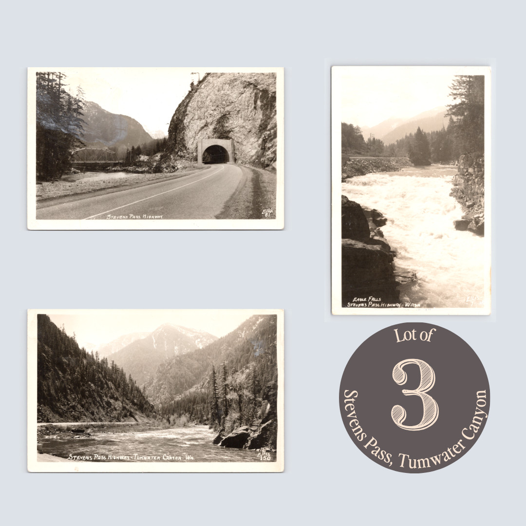
Stevens Pass carries US Highway 2 through the Cascades at 4,061 feet, connecting Puget Sound to the Columbia River basin. Paved in 1931, it quickly became one of Washington\'s defining scenic drives, and Ellis became its primary visual chronicler — producing a numbered series that documented the route mile by mile.
These three cards cover the highway\'s most dramatic western stretch. Eagle Falls drops 25 feet on the South Fork Skykomish River near Index, a high-volume cascade visible from the road that has drawn swimmers and picnickers since the highway opened.
A few miles east, a rock tunnel blasted through granite marks the canyon passage above the Wenatchee River Bridge — a steel truss span originally built as a railroad bridge in 1900, converted to highway use in the 1930s, and finally replaced around 2012.
Continuing east, Tumwater Canyon carries the Wenatchee River through steep conifer walls toward Leavenworth, its name drawn from the Chinook word for rough water.
Sold together, the three cards form a sequential west-to-east document of US 2\'s most photographed corridor.
Zoom in on photos as they are considered part of the description.
Under $20:Ships via USPS Standard Envelope in rigid mailer.Over $20:USPS Ground Advantage, full tracking, sturdy service by default for <$20 cards; tracked options for >$20.Options:Buyer can always choose alternative shipping methods at calculated cost.Note: Standard Envelope may showdeliveredat your post office, not your mailbox. Contact me if there\'s a delay of more than 5 business days past expected date.Happy collecting! Thanks for shopping Velvet Moon!

Related Items:
c1940 Lot 3 Stevens Pass Highway Tumwater Canyon Wenatchee River Ellis RPPC WA
$19.95
C. 1940s Pennsylvania Railroad GG-1 Locomotive Snapshot Photo Lot Of 17
$225.00
C. 1940s New York Central Steam Locomotive Photo Negative Lot of (6)
$75.00