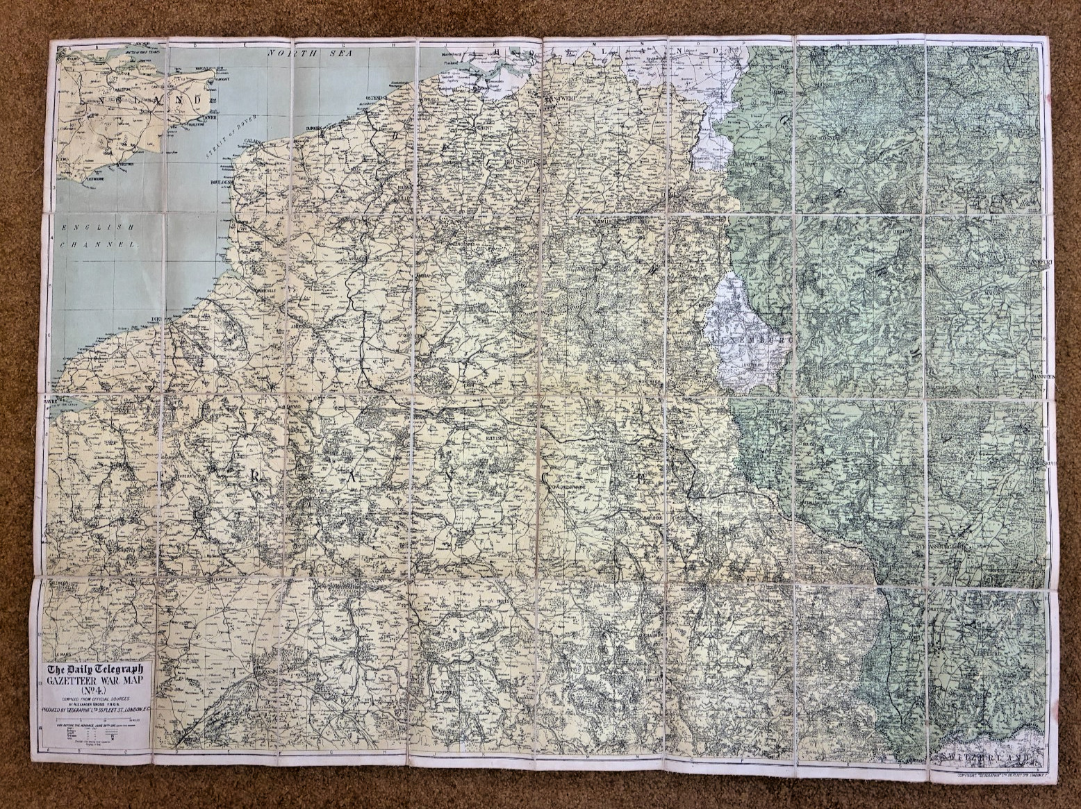
WWI-Era Linen Backed Map – Daily Telegraph Gazetteer War Map No. 4
- Title: The Daily Telegraph Gazetteer War Map No. 4
- Compiler: Alexander Gross, F.R.G.S.
- Publisher: Geographia, 55 Fleet Street, London
- Date: WWI-era, stamped November 22, 1918
- Coverage: Primarily France and Belgium
📏 Dimensions
- Full size: 40.25 x 29 inches
- Folded size: 7.25 x 5 inches
📜 Details
- Linen-backed for durability.
- Stamp on linen: “HEADQUARTERS PHILLIPINE DEPT., NOV 22 1918, OFFICE DEPARTMENT ENGINEER, MANILLA, P.I.”
- Included in a lot of WWI maps attributed to Major Baird, adding provenance interest.
🔎 Condition & Notes
- Period original, not a reproduction.
- Typical handling wear consistent with age.
- Note: Last photo shown is for reference only and not included in the sale.
📦 Collector’s Context
This is one of a series of WWI-era maps and reconnaissance artifacts I’ll be listing over the next week—more than two dozen in total. A rare opportunity to acquire historically significant cartographic material with direct military provenance.

Related Items:
Original 1918 WWI U.S. Army M1917 Eddystone Rifle Walnut Handguard NOS From Box
$18.99
1918 WWI Linen Backed War Map No.4 France Belgium Geographia London
$140.00
1918 WWI Daily Telegraph Linen‑Backed War Map No.22 France & Belgium
$150.00