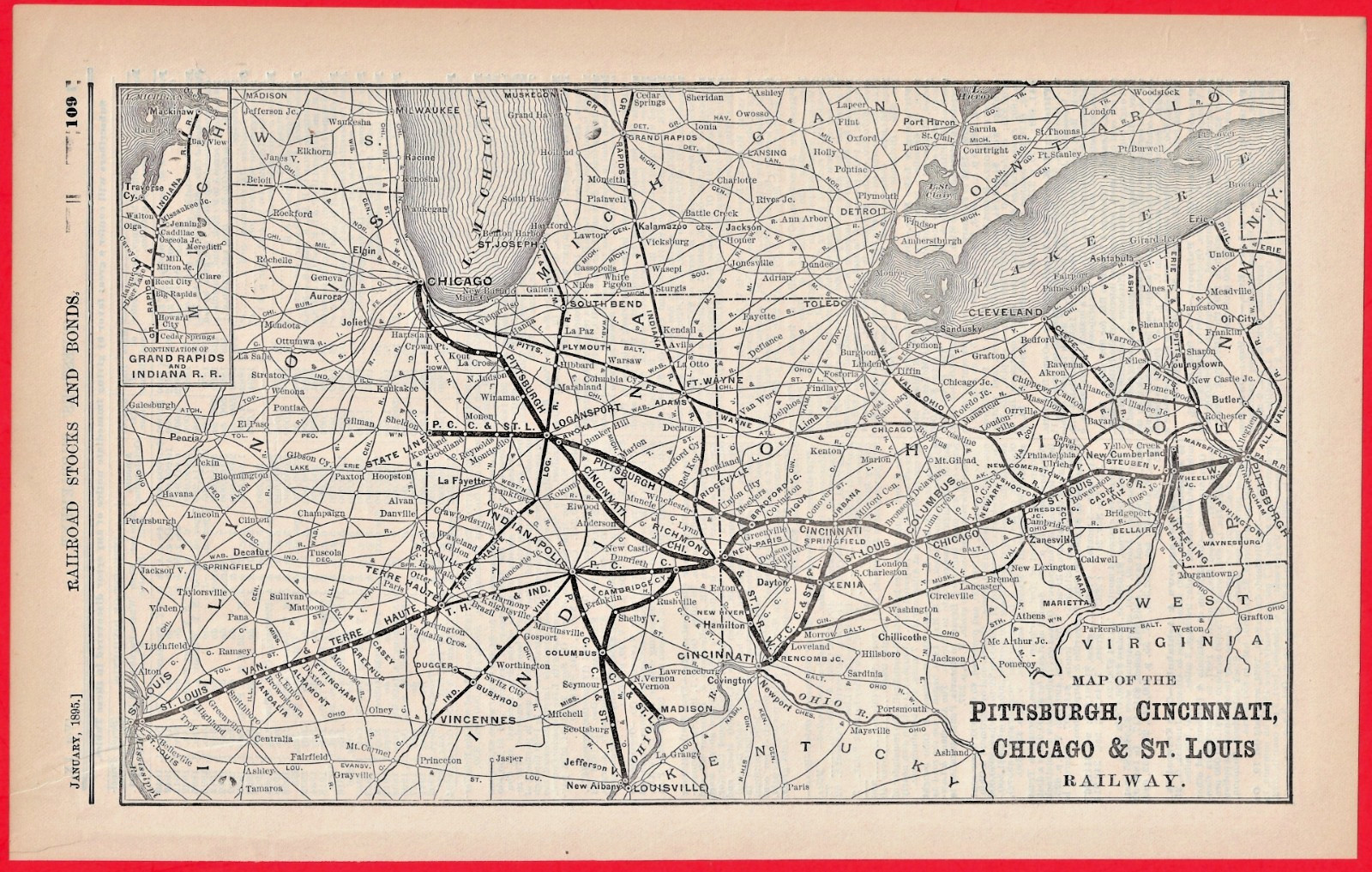
Original 1895 Railroad Map: Pittsburgh, Cincinnati, Chicago & St. Louis Railway ("Panhandle Route").Original antique railroad map from January 1895, initially published as part of the investor's supplement for the Commercial & Financial Chronicle. This is an authentic piece of 19th-century American industrial history, not a modern reproduction.
The map beautifully illustrates the sweeping network of the famous "Panhandle Route"—a core subsidiary of the Pennsylvania Railroad (PRR)—linking major manufacturing and industrial centers from Pittsburgh out to Chicago, Cincinnati, and St. Louis.
Excellent Vintage Condition. The paper shows a light natural age toning. Text and line graphics remain crisp and clear. There are no heavy stains, or deep folds affecting the central map illustration. Crisp edges. Reverse Side: Features period-accurate financial text/stock tables from the original chronicle publication.
Dimensions: Approximately 8 x 12-1/2 inches.
130 Our 27th year on

Related Items:
1895 Panhandle Route Railroad Map Pittsburgh Cincinnati Chicago St Louis Railway
$25.00
☆1895 train report FORT WORTH & DENVER CITY RAILWAY Washburn Panhandle City TX
$11.95

10103 35MM SLIDE Photo 1895 CUT UNDER BUGGY CANYON TX PANHANDLE TX
$8.08