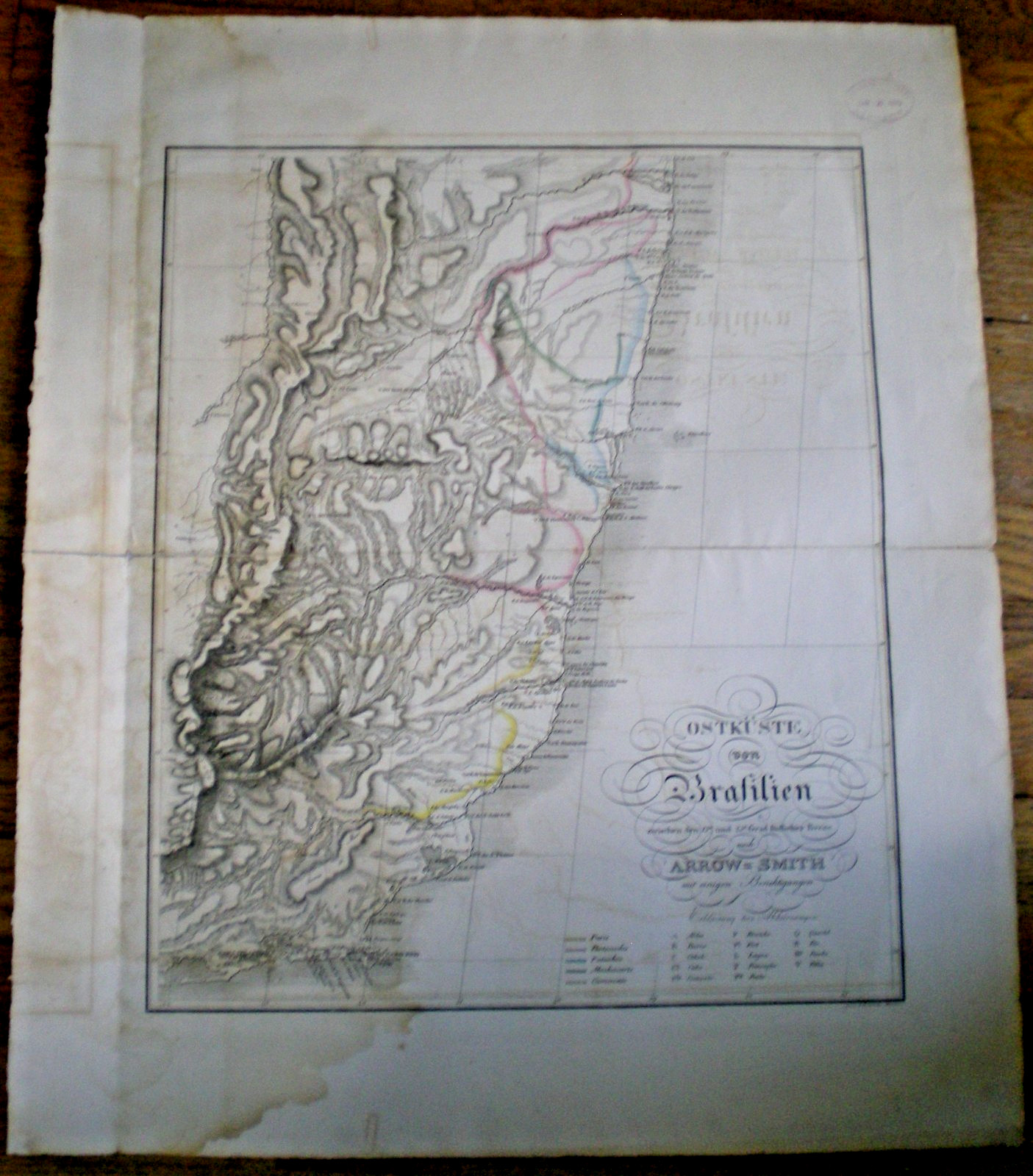
Title: "Ostküste von Brasilien zwischen den 15n und 23n Grad südlicher Breite" (East Coast of Brazil between the 15th and 23rd Degrees South Latitude).
Author/Creator: Prince Maximilian of Wied-Neuwied.
Circa: 1820–1821.
Size: Measures approximately 22-1/2 x 27 inches (overall sheet dimensions).
Scarce and highly important early 19th-century antique map charting the rugged Atlantic coastline of Brazil from southern Bahia down to Rio de Janeiro. Created by the celebrated German explorer and naturalist Prince Maximilian of Wied-Neuwied for his seminal travelogue Reise nach Brasilien, this impressive large-format engraving is highly sought after by collectors of South Americana, cartography, and ethnology.
Notably, the map accurately defines the traditional territories and migration boundaries of regional Indigenous groups, including the Botocudo, Puri, Pataxó, and Maxakali peoples. It features hand-colored accents highlighting territorial borders and coastal elements.
Provenance Mark: Features a fascinating, historic red ink rubber stamp in the top right margin reading: "The Lehigh University Library Jan 25, 1879." This provides a wonderful, documented 19th-century institutional provenance for the piece.
This map is in good, stable antique condition with honest wear consistent with its 200+ year age:
Folds & Tears: Features two original folds as issued. The center horizontal fold has a minor historic tear that has been professionally stabilized with archival-safe document tape applied to the reverse side to secure and protect the paper.
Pak30 Our 27th year on

Related Items:
1820s Map East Coast Brazil Prince Maximilian Wied Hand-Color Lehigh Univ.
$375.00
vintage late 1820s Pocket tourist map of Virginia by Finley Young and Delleker
$275.00

Antique Celestial Map Poster 📜 - 24x36” Vintage 1820s Astronomy Chart 🌌
$39.95