📌 PLEASE REVIEW ALL PHOTOS CAREFULLY — ITEM IS SOLD EXACTLY AS SHOWN.
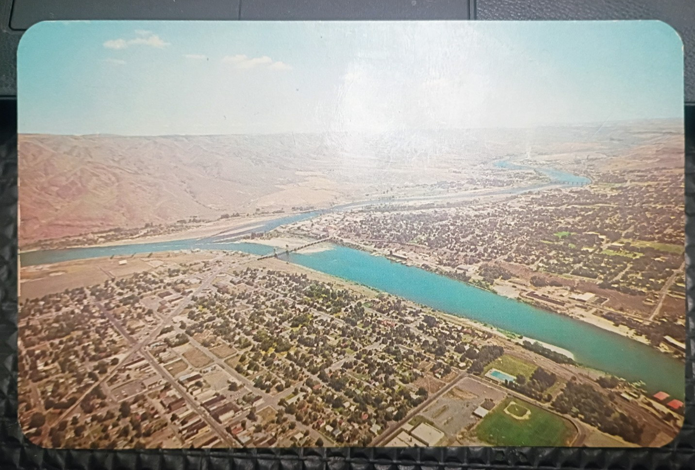
Vintage color aerial postcard showing Clarkston, Washington, featuring Main Street and Clarkston High School, with the Snake River flowing through the scene. In the distance, Lewiston, Idaho can be seen, along with the Potlatch Lumber Mill. The well-known Lewiston Spiral Highway is visible at the left side of the photo.
The reverse description notes this region has been known since Indian days for its mild winters and is referred to as “The Banana Belt.” A classic inland Northwest aerial view capturing the geography and development of the Clarkston–Lewiston valley.
Details:
Location: Clarkston, Washington / Lewiston, Idaho
View: Aerial cityscape with Snake River
Notable Features: Clarkston High School, Potlatch Lumber Mill, Spiral Highway
Publisher: Ross Hall Scenic’s, Sandpoint, Idaho
Printer: Dexter Press, Inc., West Nyack, New York
Card Type: Color postcard
Postmarked: No (unused / blank back)
**Standard postcard size
Card No.: 91445-B (printed on back)
Estimated Era
Based on the Dexter Press production mark and postcard layout, this card is generally associated with the 1960s–early 1970s era.
(No copyright year is printed; date listed as an estimate only.)
Buyer-Friendly “No Surprises” Statement
You will receive the exact postcard shown in the photos — nothing more, nothing less.
Photos are part of the description and accurately represent the item’s condition.

Related Items:
Vintage Postcard Belle Isle, Detroit, Michigan, Aerial View Unposted Unused
$2.99
4 ALL ABOUT AERIAL - Vintage HAM RADIO Antenna Book Manual Fits GERNSBACK No. 4
$17.80
Vintage Aerial Photography Technical Manual 1941 Mapping Corps of Engineers
$15.14