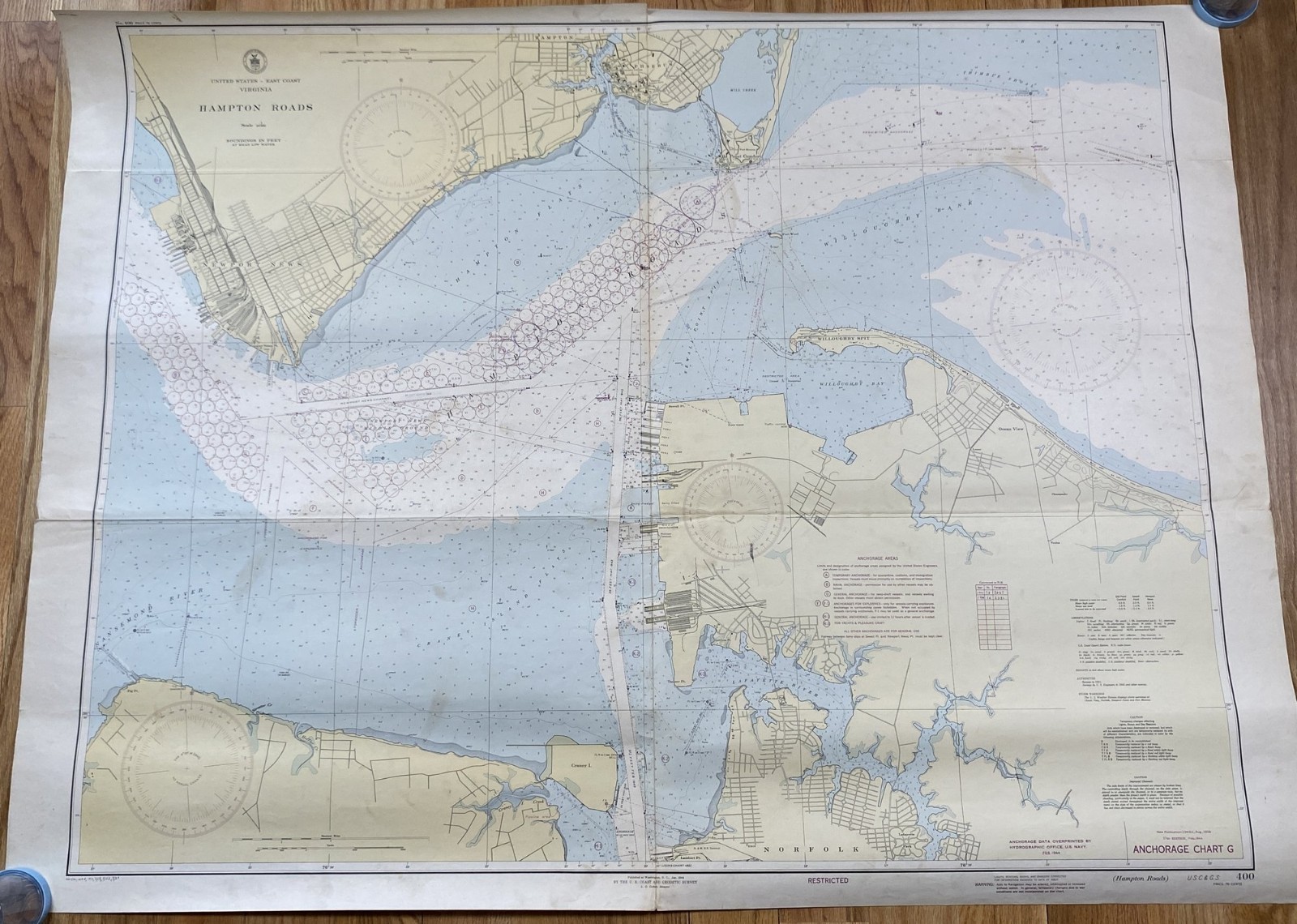
Rare original WWII-era nautical chart from the US Navy Hydrographic Office and US Coast and Geodetic Survey. This is Chart No. 400, covering Hampton Roads and the East Coast of Virginia, with depth soundings shown in fathoms.
Item Details:
Date: November 1944
Size: 35-5/8" x 53-3/4"
Produced by: US Coast Guard and Hydrographic Survey
Classification marking: RESTRICTED (wartime security designation)
Condition: Good overall. Has been folded and rolled. Shows some wear/damage along fold lines and staining along portions of the edges. See all photos.
Why It's Collectible:
Wartime "Restricted" classified nautical charts are increasingly sought after by WWII collectors, maritime history enthusiasts, cartography collectors, and Virginia/Hampton Roads history buffs. Hampton Roads was one of the most strategically vital naval ports of the entire WWII era — home to the Norfolk Naval Station and a major staging point for Atlantic operations. An original 1944 classified chart of this area is a genuine piece of naval history.

Related Items:
U.S. WWII First Aid Kit, Vehicle, Jeep, 1944, Stencil, Stencil 074
$5.00
WWII U.S. Navy Ball Recording Sextant Mergenthaler + 1944 WOOD BOX RARE LOOK
$134.00

WWII Battle of the Bulge Bastogne Ardennes 1944-45 Military Gift Display COA
$180.00